

By Vignesh Kamath and H. S. Sudhira
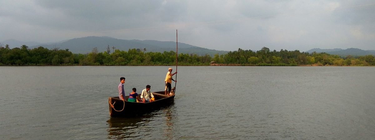
The banks of the river Krishna, an iconic river in South India, is a sight to behold! As you gaze through its vastness, have you ever wondered how the river is, and since when it is flowing? Here is a trivia—the rivers that flow in Karnataka are, in fact, older than the mighty Himalayas!
Karnataka is bestowed with seven critical river systems that are lifelines to the state—Godavari, Krishna, Cauvery, North Pennar, South Pennar, Palar, and all the west flowing rivers. The Cauvery is the largest river in the state and originates from Talakaveri in Madikeri district. Although many rivers flow to the west and join the Arabian Sea, they account for a meager 12.73% of the water that drain in the state. The majority, a whopping 87.27% of the drainage area, is a result of the six mighty east-flowing rivers. Why this starking imbalance, you wonder? There is a bit of geological history to this, and the story starts with the history of the Western Ghats, where most of Karnataka’s rivers originate.
The chronicles of the Western Ghats
Over 180 million years ago (mya), all of the present-day land mass, the seven major continents as we know them, was merged into a supercontinent called the Gondwana land. Thanks to an extraordinary geological event, the massive landmass broke up into several pieces and one of them, the Peninsular Indian plate, drifted northwards for about 100 million years. About 45 mya, it eventually hit the Asian plate resulting in the formation of the Himalayan mountain range.
During this arduous journey, the drifting Peninsular Indian plate passed through the present-day Reunion Islands, which had a volcanic centre in the Earth’s lithosphere spread over 200-300 km. The volcano, which erupted throwing out basaltic magma, resulted in the uplift of what is now the Western Ghats and tilted the Indian plate in the easterly direction. Thus, the Western Ghats are not actual ‘mountains’ but faulted edge of a raised plateau.
By the time the Peninsular Indian plate ended its northward drift and collided with the Asian mainland (between 45 and 65 mya), the Western Ghats was already there with permanently cast the drainage patterns. Hence, although most rivers in Karnataka originate in the Western Ghats, they eventually drain into the Bay of Bengal.
Ecology and Biodiversity
With a distinguished history in their origins, it is little surprise that the rivers in the Western Ghats have nurtured a unique ecosystem. The Ghats have high-altitude grasslands, the shola montane forests, wet evergreen forests, semi-evergreen, moist deciduous and dry deciduous forests. As one moves eastwards towards the plains, a bulk of the plateau is scrub—grasslands with occasional dry deciduous forests. These unique landscapes are home to several species of plants (like the Neelakurinji which blooms once in 12 years) and animals (like the endangered Lion-tailed Macaque) which are found nowhere else on Earth.
The scrublands form the catchment area and are part of the river hydrology that is responsible for capturing the incident rainwater and draining them off. Most west flowing rivers are perennial, while the east-flowing rivers depend on the monsoon rains.
Supporting livelihoods
India, an agriculture-dominated country, has over 70% of its population directly or indirectly dependent on the rivers for food and livelihood. In Karnataka, the rivers originating in the forests of the Western Ghats provide food and power security for the entire southern Peninsular India. The east-flowing rivers, which flow for thousands of kilometres before joining the Bay of Bengal, support livelihoods of hundreds of towns and villages on their downstream journey.
Massive irrigation projects on the rivers like Cauvery, Krishna, and the Godavari serve as the granary of the Deccan plateau. Apart from household consumption and irrigation, these rivers also provide water for the generation of electricity. The west-flowing rivers mostly contribute to the production of electricity to power Bengaluru's IT hub and other parts of Karnataka. The Karnataka Power Corporation Limited has 34 dams on its rivers and 24 hydropower stations across the state.
Fisheries also form a substantial means of livelihood for those who live on the banks of these rivers and their tributaries. The livelihood means of tribals and other local people also largely depends on these river systems.
Rivers for Development
Since the east-flowing rivers are vital sources of water for drinking and irrigation, large dams have been built in the past to cater to these needs. With the generation of hydroelectricity gaining momentum in the last century, several hydroelectric projects came up along the Western Ghats. A series of dams have been built along the Sharavathi, which has reduced the natural flow of the 140 km long river to a mere 8 km! The ecological impact of dams has been irreparable. For instance, several species of stream fishes are unable to move across the stream for breeding since they are now confined to one side of the dam. Some species, which swim upstream for reproduction, are now restricted.
The construction spree of these massive dams took a break in the 1970s after a protest by locals against building a dam across River Bedthi. However, in the past decade, there has been a resurgence of small dams instead of the large ones, including the controversial Yettinahole project taken up by the Government of Karnataka.
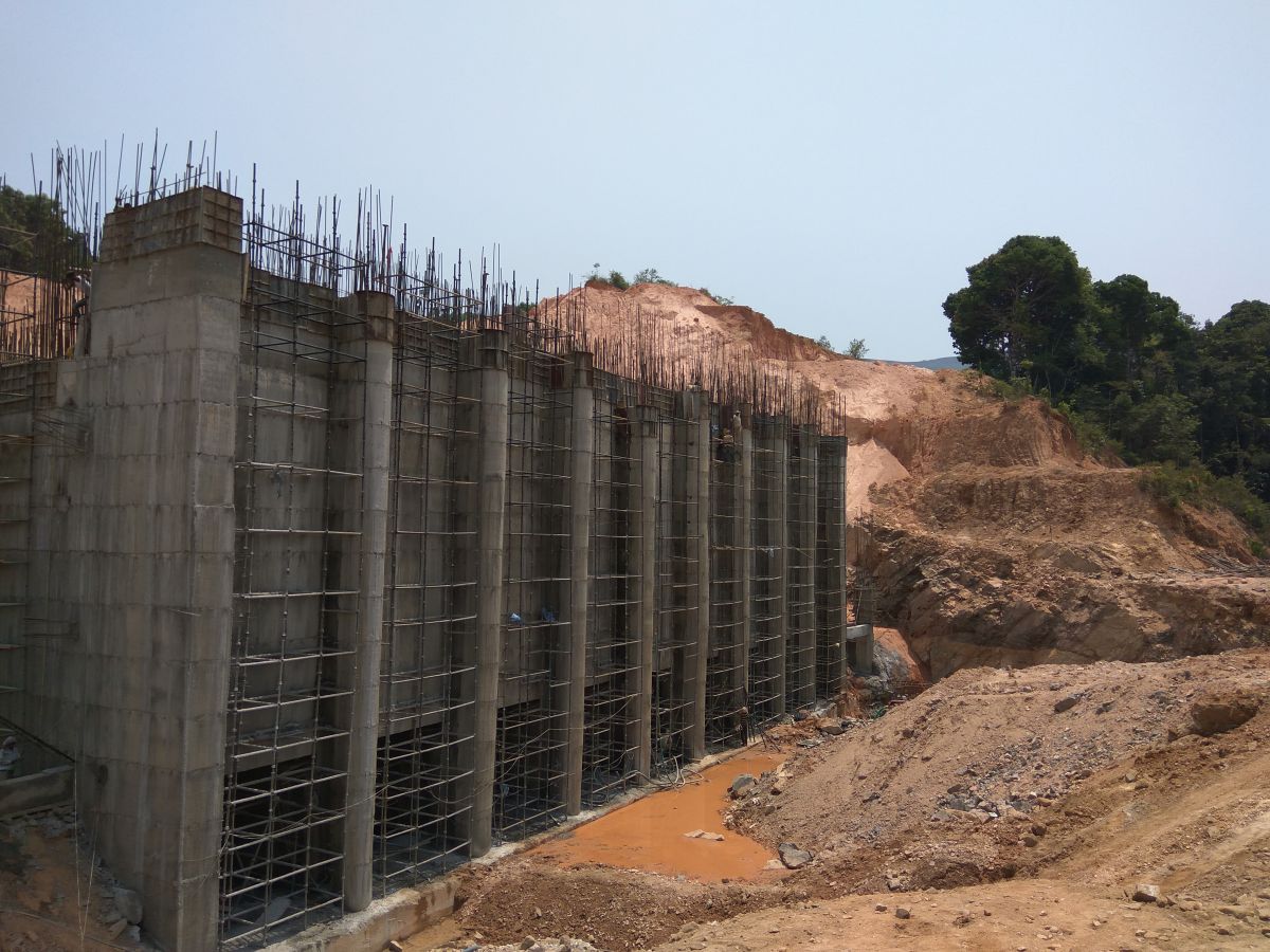
The Yettinahole River Diversion Project
Two rivers, Kempuhole and Kumaradhara, originate in the Sakleshpur taluk of Hassan district and flow westwards through the Western Ghats and drain into the Arabian sea. A massive ongoing project aims to divert nearly 24 TMC of water from the headwaters of the Kempuhole river, a tributary of the Netravati, towards the water-scarce regions of Kolar, Ramanagara, parts of Hassan, Tumkur, Chikkaballapur, Bengaluru Rural, and Devanahalli Industrial area.
The project also plans to divert the west-flowing Yettinahole stream, which eventually joins Kempuhole, through eight diversion weirs/dams and a canal network spanning 1,000 kilometres. The water will be pumped from the weirs through giant pipes that cut across the Western Ghats to channel this water eastwards. Seven massive storage reservoirs are also planned to be constructed in other parts of the state. This project, estimated to cost about Rs 13,000 crore, is energy and resource intensive and is expected to hurt the biodiversity of the region.
The recent floods in Madikeri district and Kerala ring a warning bell for pursuing any alterations to the ecology of the Western Ghats and rivers in particular. Understanding the river hydrology and floodplains, which form diverse habitats for flora and fauna, can go a long way in arriving at sustainable solutions. Time and again, ecologists have raised concerns against river linking and the threats it can cause to larger ecosystems. It is crucial that policymakers apply an integrated river water management framework that is evolved at a watershed level. Development goals should be evolved locally, and the water demands should be assessed at watershed levels. Unfortunately, it looks like the developmental activities at Yettinahole is another disaster in the making.
(This is an edited/revised version of the article published in Deccan Herald on 22 Sept 2018. Also published in Research Matters here.)
