
On this World Cities Day, let us visit the 20 'Smart Cities' selected by the Ministry of Housing and Urban Affairs (MoHUA), Government of India under the Smart Cities Mission. While the genesis 'Smart Cities' is debatable, let us not get there but one has to address the nature of 'governace' envisaged for these 'Smart Cities' given the theme of Innovative Governance and Open Cities.
Cities, as they have evolved, without any intelligent design or through a guided 'planning' are prime examples of self-organising complex adaptive systems. The numerous interactions across scales (time and space) between different entities and stakeholders are driving the emergence of cities. Though some human-intervened controls through legislations, administrative structures, policies, schemes and programmes are effected, the outcomes are often surprising and unpredictable. The manifestations of these interactions drive a few clear points.
One, primarly that as Michael Batty notes, our understanding of cities is woefully inadequate - calling for a new kind of science of cities. The new kind of science of cities is not only to explain why and how the cities behave the way they do - eg. they exhibit scaling; but to enrich our understanding of how they function. This requires a trans-disciplinary approach and needs to build on the existing body of knowledge while questioning some of the existing notions.
Two, from a city planning perspective, it is only recent that there have been a few approaches that suggests acknowledging the city functions. Often there has been a clear calling to shed the approach of making 'geometrically sound' Master Plans to a more integrated spatial planning that acknowledges different fucntions of the city. In India at the least, this will require the acknowledgement and adoption of technology appropriately including geospatial technologies. From a legal stand-point, the methods of preparing the master plan are frozen and outdated. They need an urgent attention. Methods of integrated Spatial Planning Support System offer promise to make entire master planning exercise open, dynamic, interactive, participative and responsive.
Three, the nature of governance that we seem to arrive as solutions are inept and unresponsive. They still go under the assumption of structure driving function than the other way. In India, with most cities under a regime of 'State Capture', respective city governments have little or no role in governance since key decisions and policies are guided by the State actors and parastatals. The undermining of democratic process in the urban local bodies (also an outcome of incompetent elected representatives) compounded by technocratic and entrepreneurial bureaucracy has led to a new ind of public management systems. The case in point is the creation of Smart City Limited Companies with a Board of Directors decided by the State and Centre. It is only a matter of time that their effectiveness will be known.
Four, cities generate vast amount of data - be it mobility or consumption of resources (energy, water, etc). Despite the hype on big data and their analysis, we are still way behind from putting in systems that capture and help make sense of the data. Some cities have even toyed with the notion of Intelligent Transport Systems putting in location enabled devices to track and generate their commuting data - KSRTC and BMTC have attempted these in Mysuru and Bengaluru respectively. Again - two ponits emerge: One, what is 'intelligent' about these systems? Are these systems using the commuting data and are fed through an algorithm to derive decisions on their upcoming schedules or routes? NO. Two, how much of these data are open? None. Although, the 'Smart Cities' give us an imagination of harnessing the data and thus crunching them in real-time to guide 'informed' decisions, the realisation of these require more systematic and structural changes.
The nature of governance as exhibited by political and bureaucratic establishments poses grave challenges, since citizens who are at the receiving end who may have to ‘live’ with the manifestations effected by these establishments. In the course of evolution of the city, it emerges that both political and bureaucratic establishments have deeper insights into the functioning than the citizen. As a consequence, both of these establishments know how to manoeuvre and when both of them cooperate on regressive policy and schemes; this can degenerate the system at large. However, this also suggests that when they cooperate on progressive policy, it has potential for betterment of services delivered to the citizens. It remains to be seen what mechanisms and incentives will create an ecosystem conducive for pursuing a progressive agenda in a cooperative manner.
Though satellite remote sensing data for cities has been available for over 3 decades now, they have not been yet well harnessed to ascertain the shape, size, form and functions. Most use of satellite remote sensing data has been restricted to study the urban sprawl. We present here the timelapse as made available by Google Earth Engine for the 20 Smart Cities in India. Perhaps, this should also guide us to understand and enrich the science of cities. Again, as Michael Batty says, "the more we know, the less we would want to interfere, but in more meaningful ways."
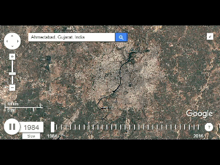 Ahmedabad | 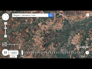 Belagavi |
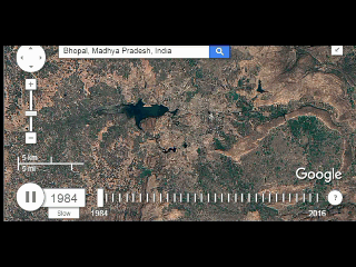 Bhopal | 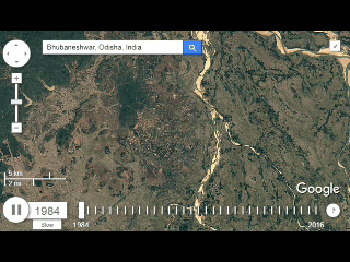 Bhubaneshwar |
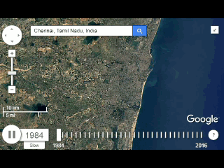 Chennai | 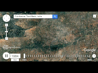 Coimbatore |
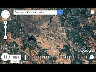 Davangere | 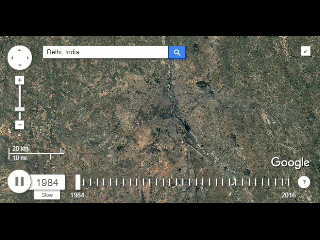 Delhi |
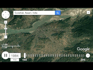 Guwahati | 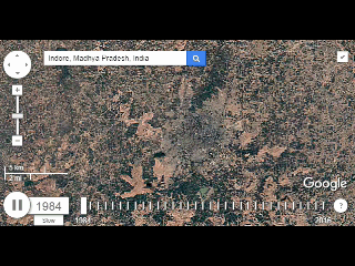 Indore |
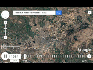 Jabalpur | 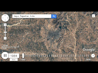 Jaipur |
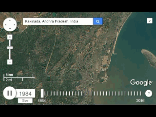 Kakinada | 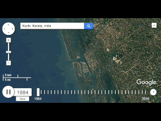 Kochi |
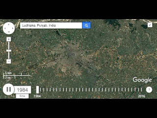 Ludhiana | 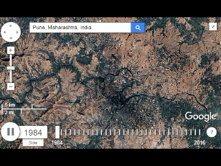 Pune |
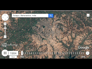 Solapur | 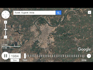 Surat |
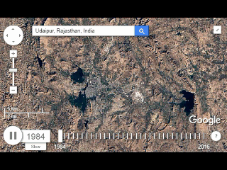 Udaipur | 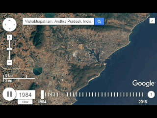 Vishakhapatnam |
